Universally Accessible Paths & Mountain Boardwalks
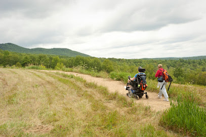
Crotched Mountain Accessible Trails
Location: 1 Verney Dr, Greenfield, NH 03047
Phone: (603) 668-7584
Trail Type: Paved & Wide Crushed Stone / Wheelchair Accessible
A gold standard for inclusive outdoor design. These meticulously engineered trails wind gently through peaceful upland forests, leading directly out to a stunning mountain overlook deck featuring sweeping vistas of the valley.
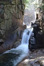
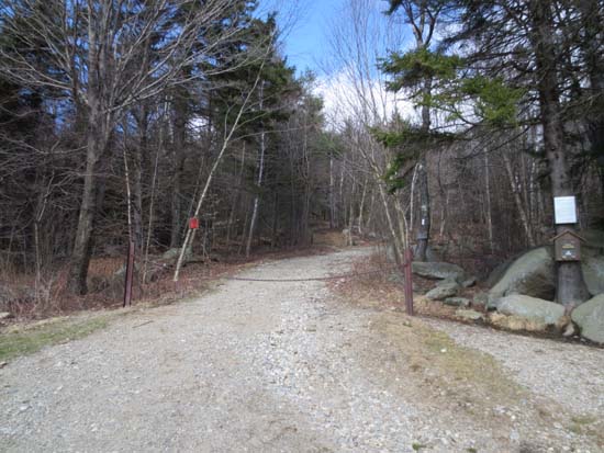
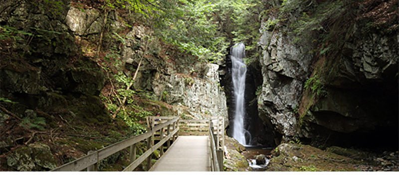
Sabbaday Falls Trail
Location: Kancamagus Hwy, Conway, NH 03818
Phone: (603) 447-5448
Trail Type: Packed Gravel & Level Wood Walkways / Stroller Friendly
A fantastic, short 0.3-mile pathway that approaches a rushing mountain waterfall canyon. The majority of the trail is incredibly smooth and easy to navigate with a robust stroller, ending at clear viewing platforms.
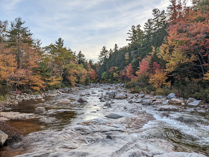
Rocky Gorge Scenic Area
Location: Kancamagus Hwy, Albany, NH 03818
Phone: (603) 447-5448
Trail Type: Paved Walkway & Footbridge Crossing / Easy Route
Offers rapid, highly accessible views of a roaring mountain river gorge channel. The main paved path leads visitors safely from the parking area directly to a sturdy, level wooden bridge crossing above the crashing rapids.
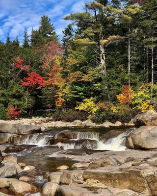
Lower Falls Scenic Area
Location: Kancamagus Hwy, Albany, NH 03818
Phone: (603) 447-5448
Trail Type: Short Paved Promenade / Riverside Overlook
An exceptionally convenient mountain pull-off location situated right on the banks of the scenic Swift River. Features paved paths running alongside the rocky river shoals, complete with accessible picnic spaces.
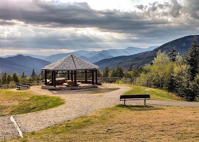
Pemigewasset Overlook
Location: Kancamagus Hwy, Albany, NH 03818
Phone: (603) 536-6100
Trail Type: Level Paved Landing & Sheltered Pavilion
Provides spectacular, sweeping panoramic views of the Osceola Mountain Range without requiring any strenuous climbing. Features a wide, flat stone viewpoint area and an informative, covered educational pavilion.
Short, Easy-Grade Mountain Footpaths (Big View / Low Effort)
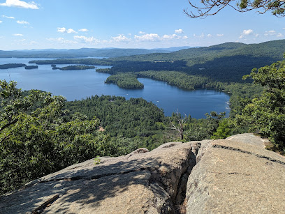
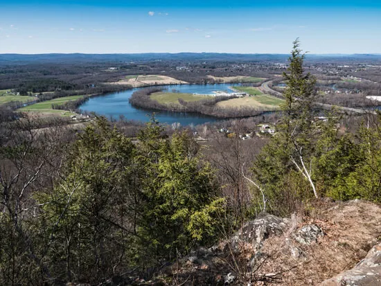
West Rattlesnake Mountain Trail
Location: Route 113, Center Sandwich, NH 03227
Trail Type: Wide, Gently Graded Dirt Path / Easy Climb
Famous as one of the highest reward-to-effort hikes in the region. A short, highly manageable grade brings you up to wide, open granite ledges providing jaw-dropping views over Squam Lake and its green islands.
Pitcher Mountain Trail
Location: 2190 NH-123, Stoddard, NH 03464
Trail Type: Short Graded Meadow Trail / 360-Degree Views
An incredibly short, gentle stroll up a wide historic path through high blueberry pastures. The summit features a historic mountaintop fire tower and drops a massive, unobstructed 360-degree mountain panorama at your feet.
Castle in the Clouds (Shannon Pond Loops)
Location: 455 Old Mountain Rd, Moultonborough, NH 03254
Phone: (603) 476-5900
Trail Type: Flat Manicured Pathways & Lakeside Walking Trails
Surrounding a beautiful historic mountain estate, this property features incredibly smooth, flat pathways outlining Shannon Pond. Ideal for leisurely strolls past mountain streams and pristine mountain views.
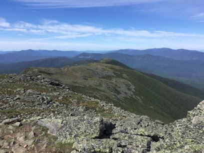
Mt. Washington Summit State Park
Location: 1598 Mt Washington Auto Rd, Mt Washington, NH 03589
Phone: (603) 466-3347
Trail Type: Paved Summit Walkways / Accessible via Auto Road or Rail
Stand on the highest alpine peak in the Northeast without grueling mountain climbs. By utilizing the historic Auto Road or Cog Railway, visitors step directly onto flat, paved observation platforms spanning the clouds.
Long-Distance Regional Corridor Trails
New England National Scenic Trail (Metacomet Segments)
Location: 319 Rte 80, Guilford, CT 06437
Website: New England National Scenic Trail
Trail Type: Maintained Regional Dirt Footpaths
A massive interstate trail network spanning through Connecticut and Massachusetts. While some mountain peaks get highly technical, the low-lying valley and meadow trail sections are flat, clear, and well-marked.