New Hampshire: Dramatic Gorges & Glacial Boulders
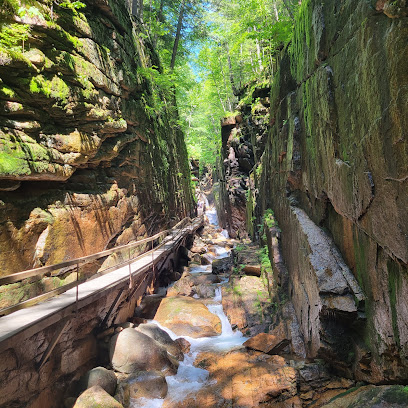
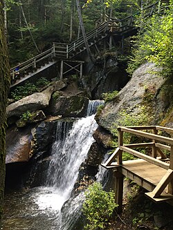
The Flume Gorge & The Basin
Location: 855 Daniel Webster Hwy, Lincoln, NH 03251
Website: The Flume Gorge & The Basin
Geology Type: 800-Foot Sheer Granite Chasm & Massive Flow Pothole
Located in Franconia Notch State Park, this legendary 2-mile loop walk features a spectacular wooden boardwalk clinging to 90-foot-tall vertical granite walls. Just down the parkway sits "The Basin," a smooth, 30-foot-wide glacial pothole worn to a flawless polish by centuries of cascading water.
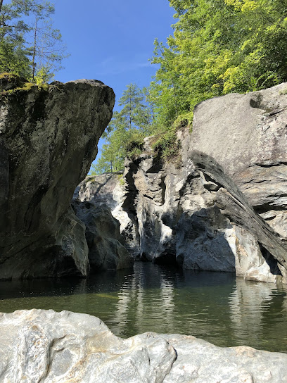
Lost River Gorge & Boulder Caves
Location: 1712 NH-112, North Woodstock, NH 03262
Phone: (603) 745-8031
Website: Lost River Gorge & Boulder Caves
Geology Type: Jagged Glacial Ravine & Shifting Boulder Talus Caves
A ruggedly beautiful 1-mile boardwalk path that winds deep through a steep ravine where the river vanishes and reappears beneath massive blocks of stone. Features 11 historic boulder caves formed by crushing Ice Age debris that adventurous visitors can actively crawl through.
Sculptured Rocks Natural Area
Location: 251 Sculptured Rocks Rd, Hebron, NH 03241
Phone: (603) 271-3556
Website: Sculptured Rocks Natural Area
Geology Type: Water-Carved Bedrock Canyon & Deep Curved Chutes
A fascinating, 272-acre state park where the Cockermouth River has hollowed out a narrow, winding canyon. Thousands of years of post-glacial flow have carved remarkably deep potholes, smooth pockets, and complex, wave-like stone arches directly into the bedrock schist.
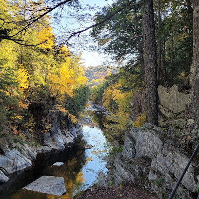
Vermont: Deep Chasms & Hidden Peaks
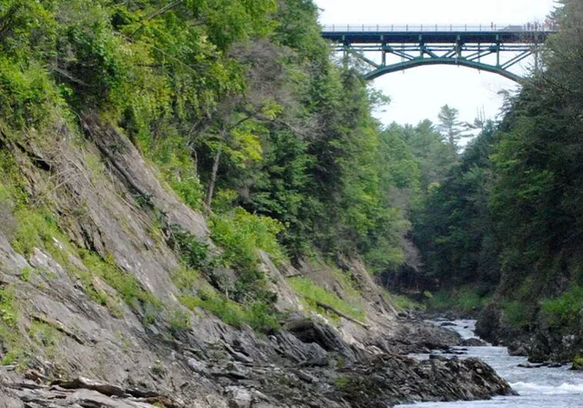
Quechee Gorge (Quechee State Park)
Location: 5966 Woodstock Rd, White River Junction, VT 05001
Phone: (802) 295-6852
Website: Quechee Gorge (Quechee State Park)
Geology Type: 165-Foot Deep Glacial Chasm & Broad Canyon Trail
Known widely as "Vermont's Grand Canyon." Carved roughly 13,000 years ago by aggressive glacial activity, this massive gorge drops 165 feet down to the rushing waters of the Ottauquechee River. An easy, wide 2.2-mile round-trip trail leads travelers from the visitor center right down onto the chasm floor.
Huntington Gorge
Location: Dugway Rd, Richmond, VT 05477
Website: Huntington Gorge
Geology Type: Raw Roadside Bedrock Schist Chutes & Deep Plunge Basins
A dramatic, raw, and powerful roadside attraction managed by the Vermont River Conservancy. The raging river currents have sculpted the local bedrock into narrow, steep chutes, foaming water steps, and deep stone-carved bowls. Visitors must remain strictly on designated paths due to dangerous currents.

Burnt Rock Mountain Pothole
Location: Hedgehog Brook Trail (Plunkton Rd), Fayston, VT 05660 Geology Type: High-Elevation Subglacial Stream Pothole (2,820 Feet)
For avid hikers, an adventurous spur trail off the iconic Long Trail reveals an incredibly rare geological anomaly: one of the highest known glacial potholes in New England. Geologists believe this smooth alpine bucket was bored by a high-pressure subglacial torrent locked beneath the ancient ice sheet.
Massachusetts: The Ultimate Pothole Hub & Granite Walls
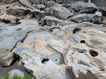
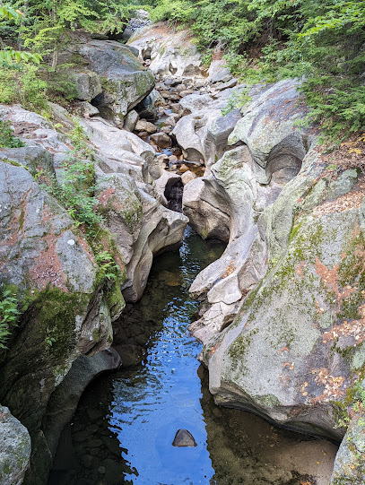
Shelburne Falls Glacial Potholes
Location: Deerfield Ave, Shelburne Falls, MA 01370
Geology Type: Over 50 Distinct Bedrock Pools & Record-Sized 39-Foot Pothole
This historic site boasts one of the largest concentrations of natural glacial potholes on earth. Nestled along the Deerfield River, these 50 ancient pools were bored out of solid metamorphic rock by spinning stones in rushing meltwater. Features a spectacular 39-foot-wide pothole viewable from a secure village observation deck.
Chesterfield Gorge
Location: 432 Ireland St, West Chesterfield, MA 01084
Website: Chesterfield Gorge
Geology Type: 30-Foot Vertical Granite Canyon & Woodland Cliff Path
A pristine, scenic reservation managed by The Trustees of Reservations. Visitors can wander a level cliff-top path to look directly down into a steep, 30-foot granite canyon carved cleanly away by ancient meltwater torrents. Features excellent historic stonework and scenic river viewpoints.
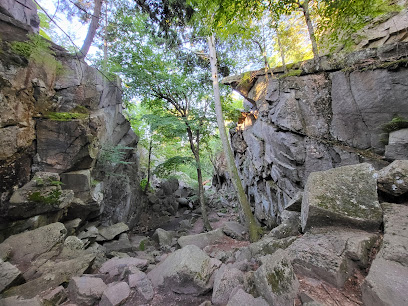
Purgatory Chasm State Reservation
Location: 198 Purgatory Rd, Sutton, MA 01590
Phone: (508) 234-3733
Website: Purgatory Chasm State Reservation
Geology Type: 70-Foot Deep Fault Fissure & Glacial Meltwater Chasm
A stunning geological wonder running a quarter-mile between sheer, towering granite rock walls. Drilled out by sudden, high-pressure glacial torrents at the end of the Ice Age, the chasm floor is filled with massive boulder formations. Visitors can hike the rugged trail directly through the canyon floor or view it safely from level cliff-top paths.